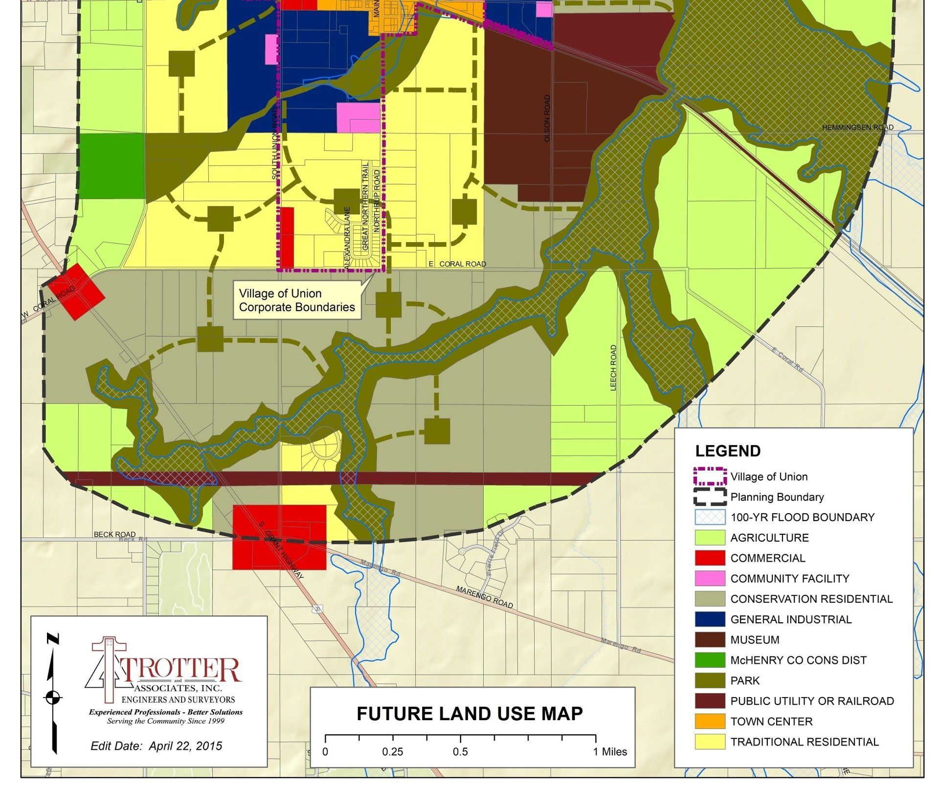
Village of Union – GIS Conversion of the Village Zoning and Land Use Plan Maps
For this project, TAI researched and updated the Village’s Zoning and Comprehensive Land Use Plan into a new ArcGIS geodatabase. The creation of the new base map allows the Village to more easily update both maps on an annual basis and start adding additional information to the ArcGIS geodatabase making it the beginning of an authoritative Village GIS mapping system.
Once the initial GIS database was created, Trotter and Associates worked together with the Village to populate additional GIS layers to assist in future decision making and budgeting.
The Village used GIS in several successful CDBG grant applications to show how monies provided by the CDBG grant would help, not only the Village, but also help meet several of McHenry County’s Consolidated Plan Activities and Progress goals along with the CDBG program goals.
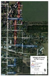
The Village of Union used additional layers of information from their GIS to help locate roads and their attribute data to help them determine what roads to update with their MFT funds. The Village was also able to identify and start budgeting for additional roads that need rebuilding or maintaining.