Village of Fox Lake – Public/Private Boundaries Water and Sewer Project
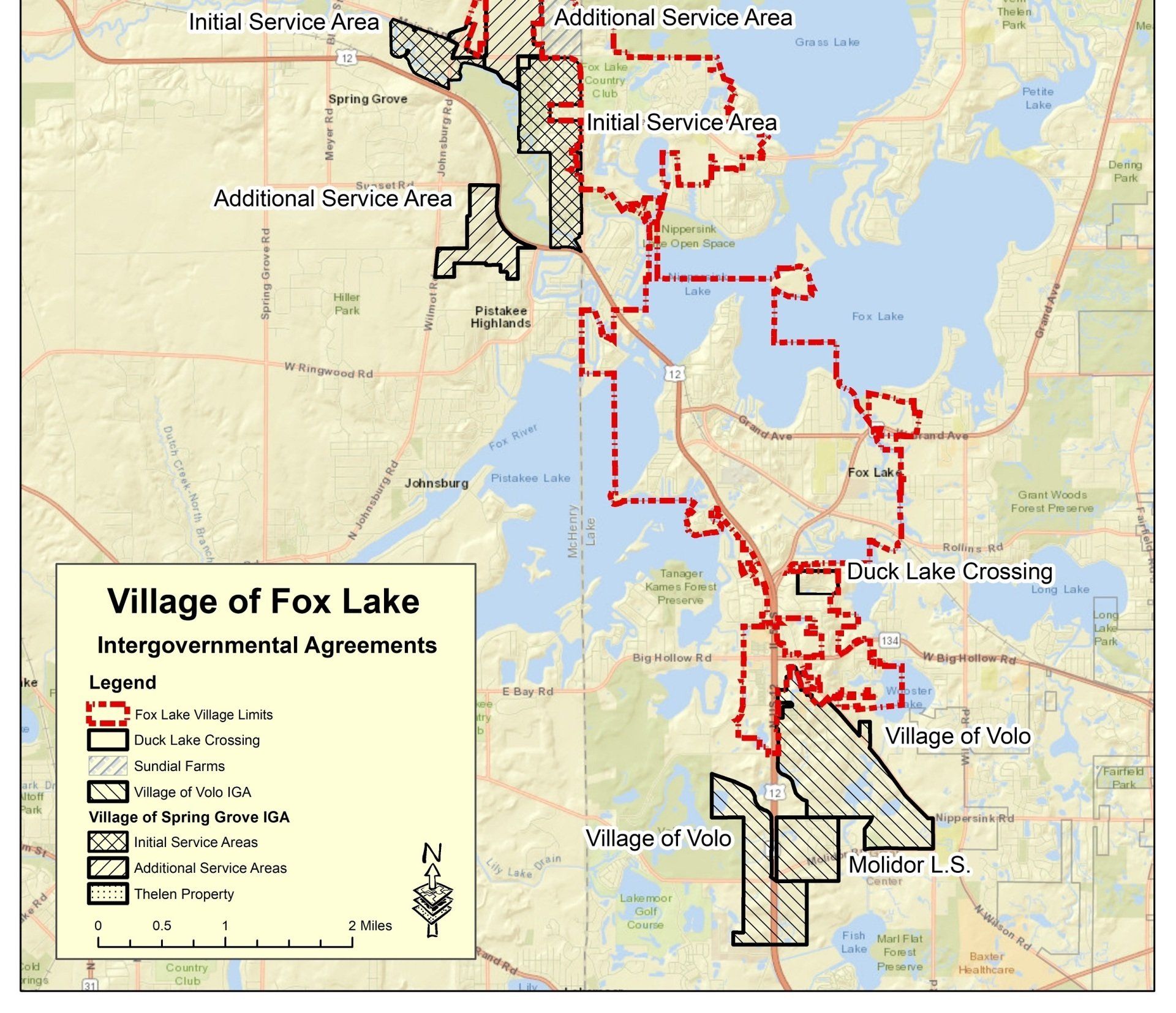
The Fox Lake Water Department was struggling to identify all existing taxing boundaries within the community and wanted to ensure that the residents were being billed in accordance to their respective tax districts. The Village residents also showed an interest in finding out who is responsible for both water and sewer utilities.
TAI reviewed the current intergovernmental agreements that the Village had setup in conjunction with the any existing maps. The information was put into the Village’s newly created GIS which was then modified to display all of the taxing boundaries within the community. The information incorporated data from both Lake and McHenry Counties, along with additional data from the Lakes Region Sanitary District.
Once information was uploaded and integrated with the GIS base map, Arc Publisher was used to create a map readable by ESRI’s free GIS view, ArcReader. This allowed the Village to view it from any workstation that had free ArcReader installed. Ultimately, it will be viewable at any location using ArcGIS Online.
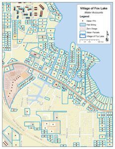
The Village of Fox Lake also needed to identify which residents were currently being billed for water and sewer and which residents were not being billed. TAI used the addresses from the billing software to show graphically which houses were actively billed for water usage.
Trotter and Associates, Inc. also utilized a geocoder to adjust the addresses from both existing parcel and existing water billing data and allow the data to be related to one another. The relationship that was created allowed water account information to be associated to the parcel data, allowing Village staff to utilize the GIS system to help manage the metered accounts. Adding this information in a spatial format on the GIS allows the Water Department to identify all metered customers making it easier to flag any residents that may be using Village water and sewer without a Village water account.