Algonquin Township – GIS Optimization, Cleanup, and Database Creation
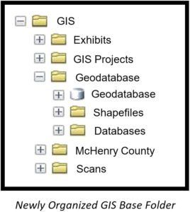
Trotter and Associates, Inc. (TAI) cleaned and optimized all of Algonquin Township’s spatial data (Esri, AutoCAD, PDF and JPG) on the Township server. The GIS database was scattered throughout more than 104 folders and sub folders, using many different coordinate systems and multiple data formats. After the initial data scrub, TAI pulled all the geographic data into one location and created a File Geodatabase, optimized for local government to host all their geographic data.
During the optimization project, TAI completed a thorough search of Algonquin Township’s server and downloaded all geospatial data, along with all the information contained in the GIS Base Folder. The data was cleaned and optimized by updating the data into an ArcGIS Local Government Information Model. Once the cleanup and optimization was complete, the data was reloaded back onto the Algonquin Township server. A thorough QA/QC process ensured that all links were clean and working. TAI also updated the Algonquin Township’s ArcGIS Desktop to the latest version.
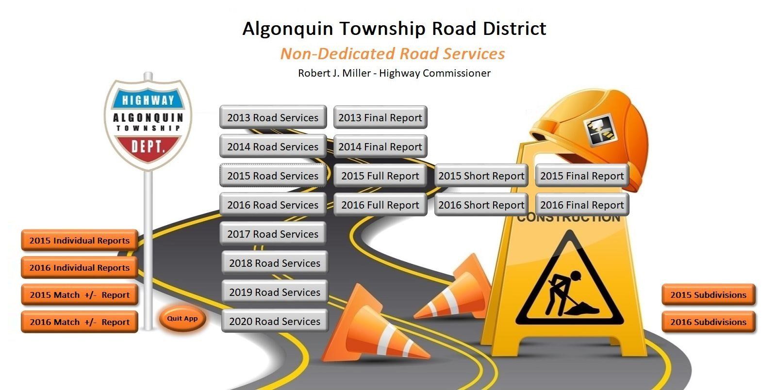
To help track projects and cost for Algonquin Township’s Non-Dedicated Road services, TAI created a tracking app that allowed the Township to log all the activities, along with their associated cost for each non dedicated road for both current and future years. TAI also created the ability to bring in earlier years data into the app for multiyear analysis and budgeting.