LAND SURVEYING
Trotter and Associates, Inc. provides professional land surveying services including boundary surveys, ALTA/ACSM Land Title Surveys, utility mapping, topographic survey, construction staking and high accuracy horizontal and vertical control. Our Professional Land Surveyors have over thirty years of experience in Boundary and ALTA/ACSM Land Title Surveys, right-of-way, easement, legal description and plat preparation. Our survey crews are equipped with the latest technology, training and safety equipment. TAI’s crew chiefs average twenty-five (25) years of experience and have worked on a wide range of projects. In addition, each member of Trotter and Associates, Inc.’s professional staff has a strong survey background. Most of the TAI team members have spent more than two years on a survey crew.
TAI is setting itself apart by providing first class surveying services. Our firm has made a commitment to performing each and every task to the best of our ability. The first step in the design process is survey and data collection. The quality of the design is dependent on the quality of field data collected. Inaccurate or incomplete data can result in delays or cost overruns in implementation of the project. For quality control reasons, TAI has invested into developing its own survey department rather than using less expensive sub-consultants. Trotter and Associates, Inc. employs a highly skilled team, provides them the most advancement equipment and is committed to the accuracy and the quality of our work.
Equipment
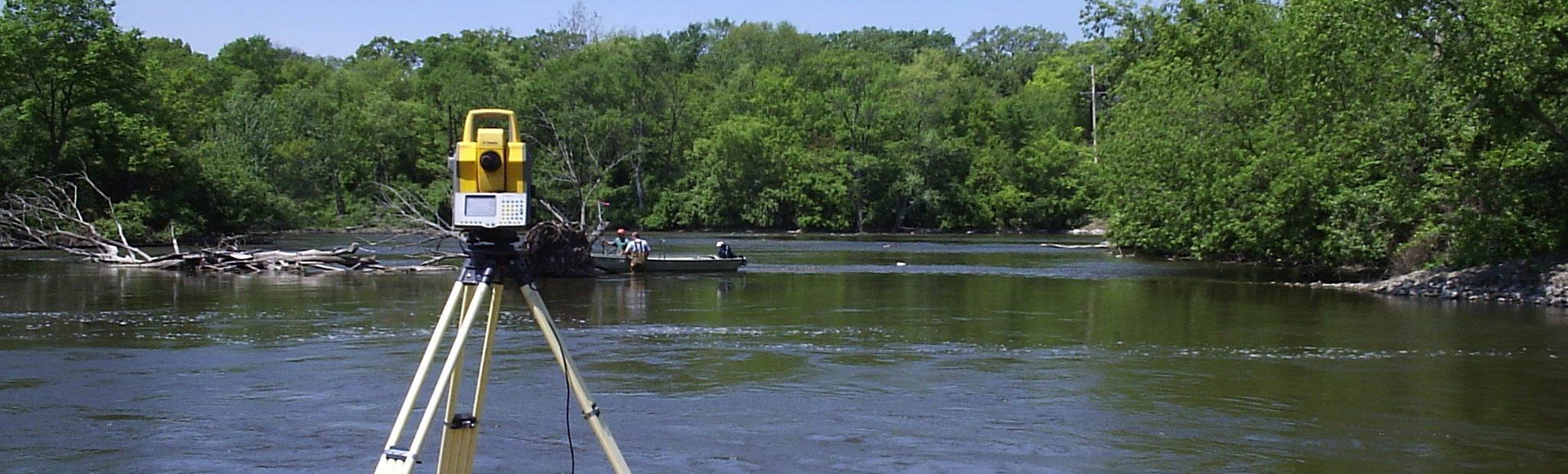
Trotter and Associates has and continues to invest in the latest technology including smart phones to send and receive data, digital cameras, Trimble robotic total stations and GNSS (Global Navigation Satellite System) equipment. The use of the GNSS GPS system allows TAI to survey in areas where the traditional GPS (Global Positioning System) receiver does not receive the necessary data from the US satellite constellation. The GNSS receiver allows TAI to access other countries satellites to allow us to continue working where others cannot. Therefore, our field crews are more efficient, and able to maintain the level of detail and accuracy for which they are known.
TAI utilizes Robotic Total Stations and Global Navigation Satellite System (GNSS) survey equipment. TAI’s use of GNSS equipment allows our crews to work efficiently and obtain data within 10 millimeters in just seconds. Where conditions will not permit or a higher degree of accuracy is required, we rely on the Robotic Total Station. Both of these systems use the same data collector, which provides a seamless transfer when combining both the GNSS and Robotic Station in the same project. Presently, TAI utilizes Trimble S5 Robotic Total Stations, R10 RTK GNSS equipment and TSC3 Survey Controllers with GNSS Accessories.
Collection of topographic information such as utility structures is accomplished with both electronic survey equipment as well as field data sheets that can be transcribed in the office.