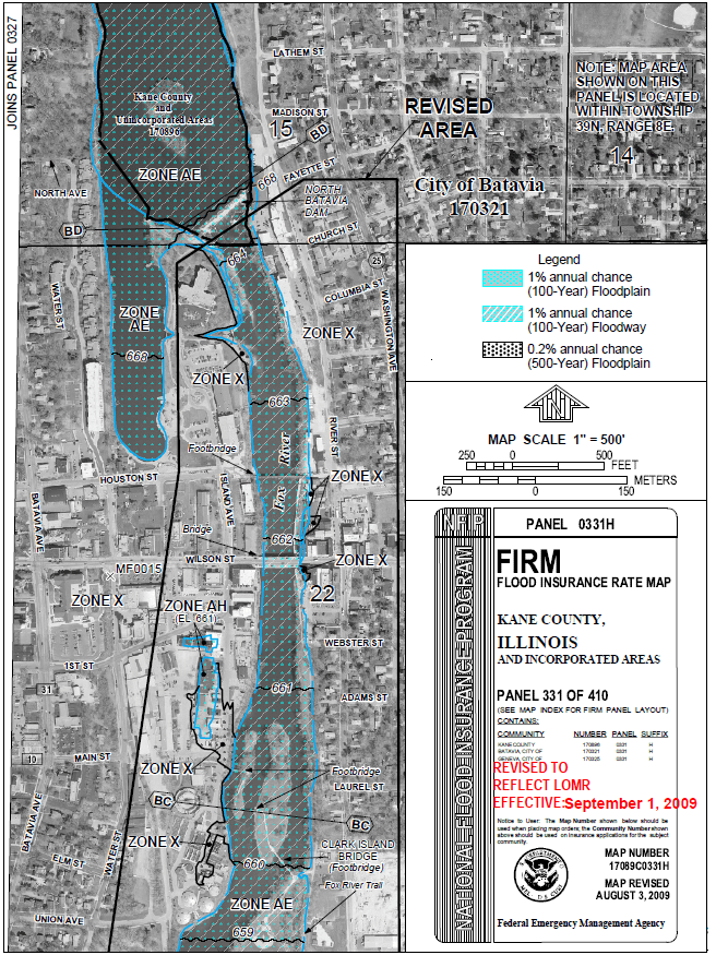
City of Batavia – Fox River Floodplain Map Revision
The City of Batavia desired to prepare an accurate, up-to-date regulatory floodplain map for the Fox River area between the North Batavia Dam and the South Batavia Dam. This reach of the Fox River had undergone significant changes in the early part of the 2000s, most notably with the removal of the South Batavia Dam. This substantial change to the river corridor, coupled with the fact that the original floodplain map was based upon coarse topographic information, prompted the City to prepare a Letter of Map Revision for this reach of the Fox River. Trotter and Associates, Inc. (TAI) conducted a thorough survey of the Fox River, prepared an updated hydraulic model using HEC-RAS, and coordinated the proposed map revision with both the IDNR-Office of Water Resources and the Federal Emergency Management Agency. The resulting regulatory floodplain map produced a lowered floodplain elevation through the downtown Batavia area, effectively removing several areas from the floodplain, which had been included when mapped nearly 25 years earlier.