Corporate Office
40W201 Wasco Road, Suite D
St. Charles, IL 60175
Phone: 630.587.0470
Fax: 630.587.0475
New LiDAR Available
New Light Detection and Ranging (LiDAR) will soon to be available for Cook, Kane, Lake, and McHenry counties. These four counties, in the northeast portion of Illinois, have a population (2014 US Census) of 6,786,231, which represents over 52% of the State of Illinois. This area is also susceptible to flooding throughout the year, which has an economic impact resulting from loss of property, business or infrastructure. Light detection and ranging (LiDAR) data will serve as the primary source for a Digital Terrain Model (DTM), contour generation and planimetric products (buildings/pavement).
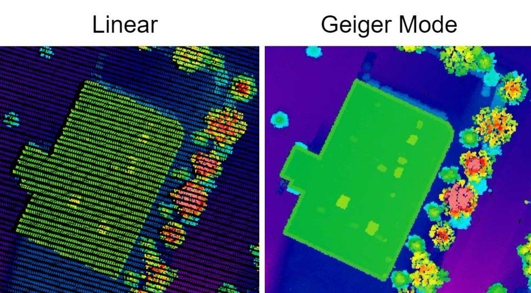
The USGS 3DEP program allowed the four counties to acquire high resolution LiDAR, making use of the improved capture ability of the Geiger Mode technologies. Geiger-mode LiDAR technology offers the most accurate elevation data available. The sensor allows for collections on a larger scale than ever before, while also collecting data up to 10 times faster and at 10 times the resolution as top-of-the-line, existing linear LiDAR sensors. The advantage of the Geiger Mode technology allows for infrastructure details to be better defined and improves foliage penetration to better sample bare earth.

The counties captured outside of their county boundaries to allow the ability to model flood events and plan preventative measures. The LiDAR data was also captured in part of the lower portion of Walworth County, Wisconsin and all of Racine and Wauconda County, Wisconsin.
The following exhibit shows the area included in the USGS 3DEP LiDAR project that is scheduled to be delivered in late spring of 2018. The four counties will also be providing the LiDAR data and the accompanying topographic data to the communities within each county.